
HRLN has grant funds available to groups in the Newcastle Electorate for on-ground landcare projects for planting and mulching, weeding and erosion control, creation of interpretive signage or guided walks, maintenance of natural areas, engaging the wider community in what Landcaring is all about. If you have a small or large project in mind, simply fill in the easy Expression of Interest form here.
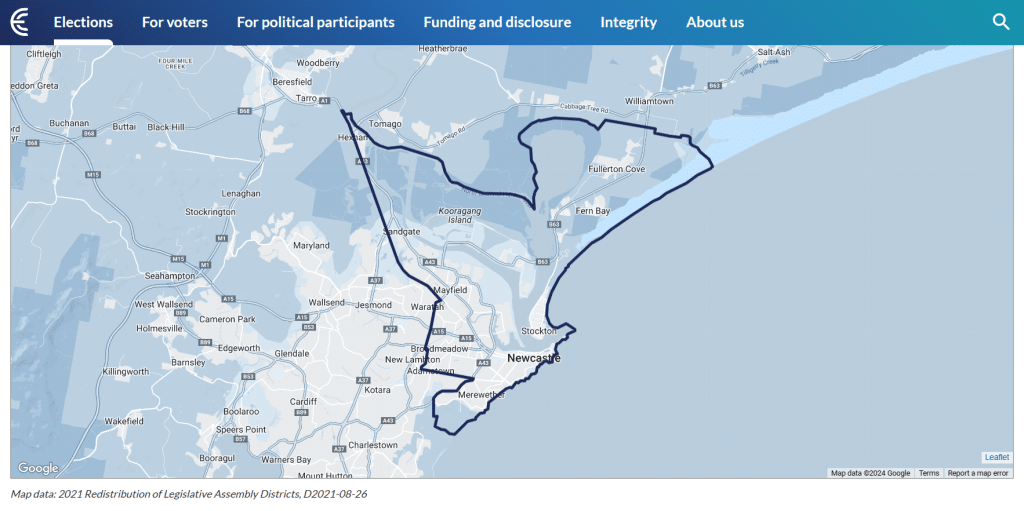
Newcastle state electorate covers roughly 120 sq km, stretching from Fullerton Cove in the north to the Glenrock State Conservation Area in the south, & west to Hexham. It contains Adamstown (part), Bar Beach, Broadmeadow, Carrington, Cooks Hill, Fern Bay, Fullerton Cove, Georgetown, Hamilton, Hamilton East, Hamilton North, Hamilton South, Hexham, Islington, Lambton (part), Maryville, Mayfield, Mayfield East, Mayfield North, Mayfield West, Merewether (part), Merewether Heights, New Lambton (part), Newcastle, Newcastle East, Newcastle West, Sandgate, Stockton, The Hill, The Junction, Tighes Hill, Warabrook, Waratah and Wickham.
For further enquiries, please contact Stacy, your Local Landcare Coordinator E: lowerhunterlandcare@gmail.com M: 0429 444 305