Soil
As Landcarers we are conscious of the soil upon which we are working. Unfortunately, the soil structure in many locations has been altered through land clearing and unsustainable agricultural practices. Today most landholders seek to maintain and improve the quality of their soils to enable improved agricultural production or to restore the soil health of the past.
Soil identification helps in understanding the use Landholders may be able to undertake in a particular location. Our last article looked at the underlying geology of our patch. Today we are looking for information that will help us understand the soils we find on our property. This can be done by visiting;
https://www.environment.nsw.gov.au/eSpade2Webapp/
After indicating acceptance of permission to use the site you should arrive at the following page:
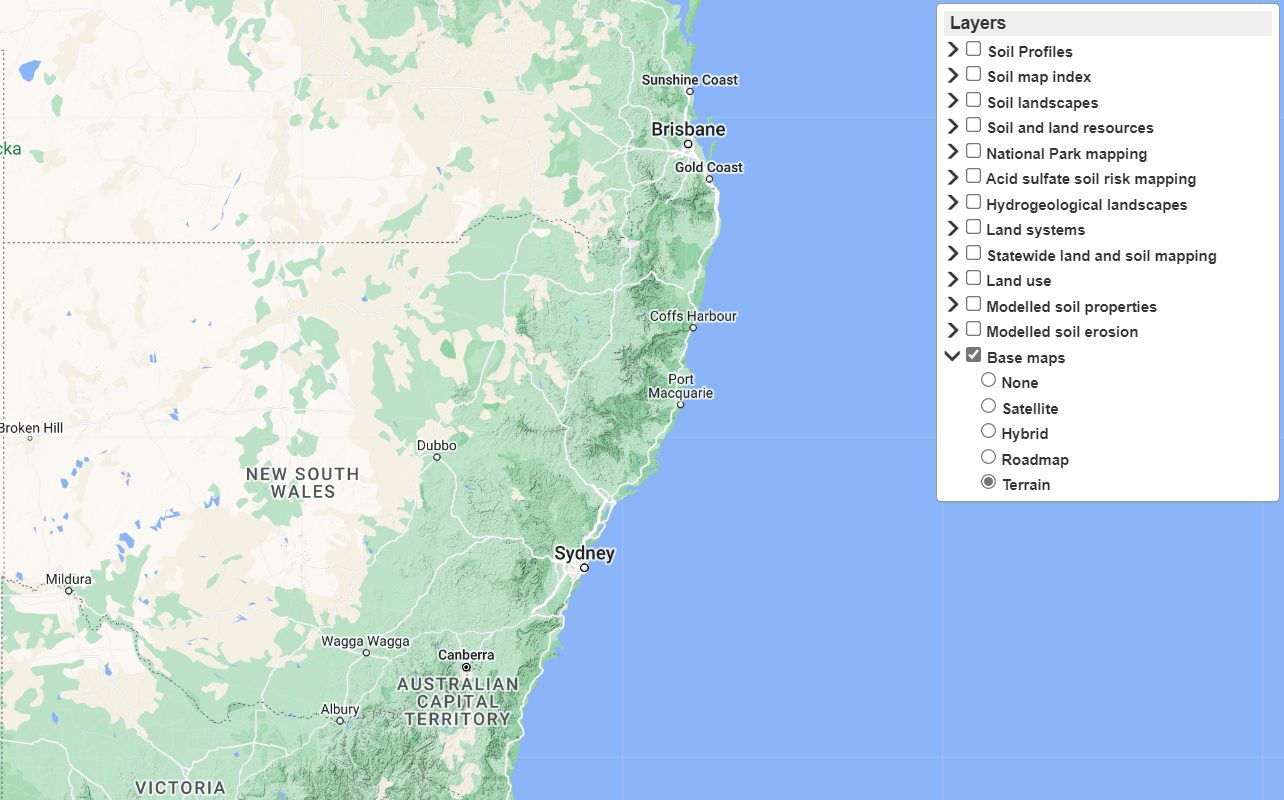
The map can be adjusted to your location and then by choosing the particular information sought in the layers check list, more details can be provided for your location.
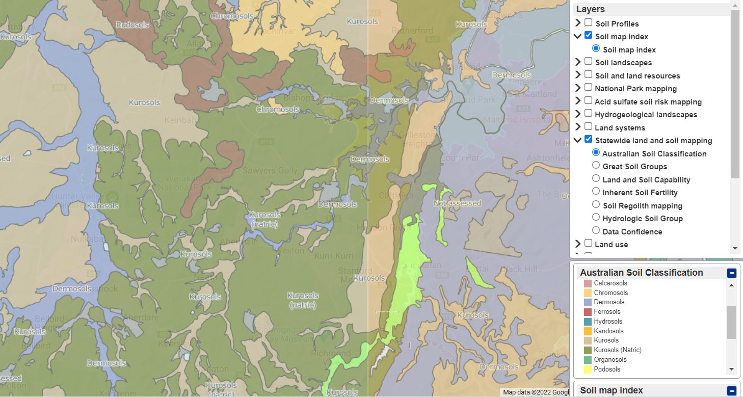
As an example, if you chose Soil Map index and State-wide land and soil mapping and Australian Soil Classification you will obtain a map like the one show below. The Blue area to the left of centre is the flood plain of Black Creek and is classified as Dermosol soil.
(The Dermosol soil is a clay soil. It is well-capable of holding water and is easily compacted. Unlike ferrosols, dermosols are low in iron. With their good structure they have a high agricultural potential. They can range from moderate to high fertility. The compact ability of the soil can be a problem after 180 years of agricultural activity and make the soil impenetrable to water, greatly reducing productivity. This was observed at St Philip’s Christian College property on Black Creek at Nulkaba.)
The Olive Green area indicates Kurosol Soils.
(Kurosols are a podsolic soils which means they are duplex soils with a sandy bleached A2 horizon and an illuvial clay B horizon which is acid (an illuvial horizon has had colloids, soluble salts, and mineral particles leached down from an overlying horizon. Some of the soils associated with the vineyards of the Hunter are on this type of soil, particularly around Lovedale.)
Another source for information regarding your location can be gained from a 2003 publication,
The Bioregions of New South Wales their biodiversity, conservation and history.
This document provides a series of textual snapshots of the conservation, character and significance of the bioregions of NSW. Each chapter presents information on a variety of characteristics of the bioregion, including both physical descriptions and its conservation status. Of significance is the series of maps for each region which can reveal broad details of the location, river systems, topography, vegetation, land tenure and subregions and landscapes.
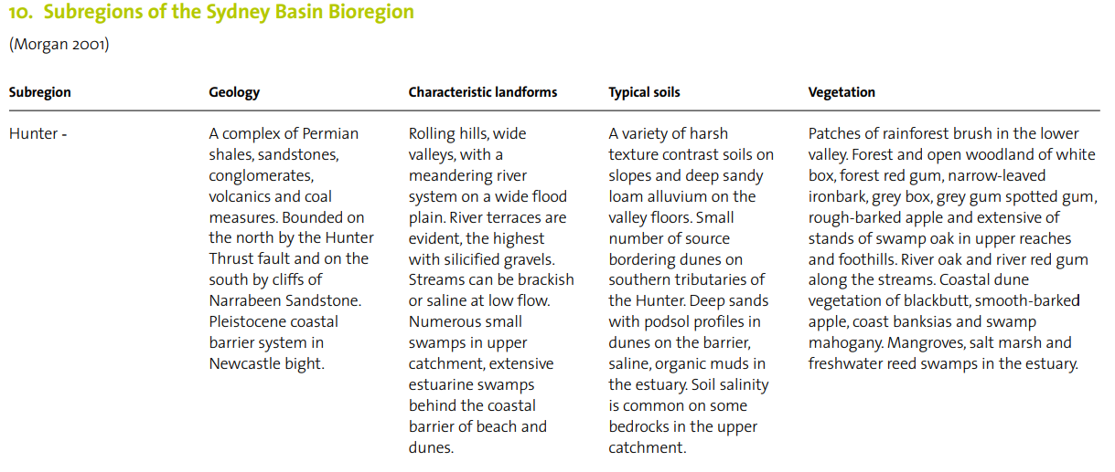
Although the publication dates from 2003 it is a valuable start to understanding your locality. For the Hunter, the following information is a thumbnail summary of the Geology and soils of the subregion as well as the terrain and vegetation. (Topics that we will examine in the future).
For Landcarers from the Manning and other regions of NSW, by scrolling down the page you can obtain the region information appropriate to your locality as a separate section rather than downloading the complete book.
Enjoy researching soil information for your property.
Happy Investigating.

