Rainfall and Topography
Our last article looked at the rainfall for the location where our farming or Landcare activity takes place. This time we take a closer look at topography to gain an appreciation of the impact of water on the surface of our locality.
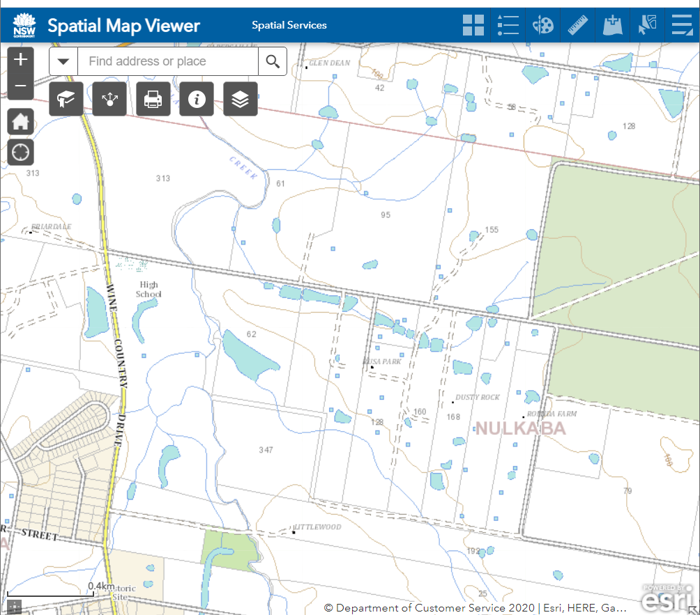
To gain a topographic map of our location we can make use of a service provided by the NSW Government which enables us to download a topographic map of our locality with 10m contour lines.
https://www.spatial.nsw.gov.au/products_and_services/topographic_maps
I have chosen to look at a high school site on Black Creek, Nulkaba.

Examining the contour lines on the map, the site is below the 80m contour mark.
This site is relatively flat suggesting that rainfall run-off on the site will move slowly across it. The site has a 2 to 3 m fall as Black Creek traverses the 1km long, eastern boundary. This is the case with light to medium rainfall.
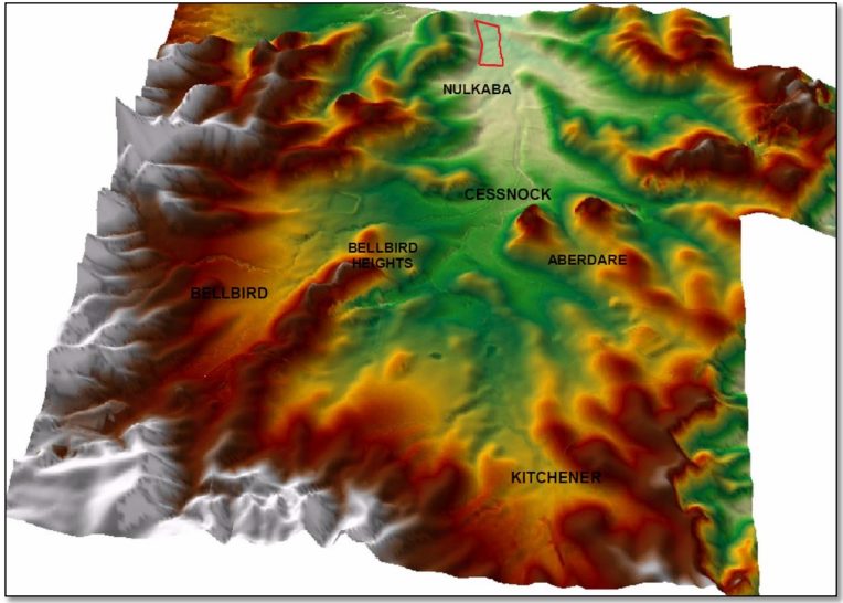
However, with heavier falls, the property is influenced by its position in the water catchment. The site has to deal with the rainfall associated with the Black Creek catchment above the site so it has to cope with the water falling on an 87.1 km² surface!

The area marked in red at the top of the relief map is the high school site. The altitude scale has been increased to emphasise the impact of the catchment above the site. (Relief map Cessnock City Council Black Creek Flood Study Final Report 2010)
Vegetation and agricultural pursuits must be prepared to deal with floods on an intermittent but regular basis, some of which approach or exceed the 1 in 100 flood. (An examination of rainfall records over more than 100 years from Cessnock and Nulkaba suggest that the site has experienced 12 floods that equalled or exceed the 1 in 100 year flood!)
In erosion prevention or reforestation, it is important to limit the soil surface exposure to the impact of heavy rainfall and flooding. Keeping vegetation cover is critical to prevent soil loss.
Your site may be steeper and if so, then the impact of light to medium falls of rain can cause erosion if the soil is devoid of plant cover! Rain droplets have a significant impact on exposed soils.
What does a 1 in 100-year rainfall event look like for your site? We will check this out next time.
Happy Investigating.

