Rainfall Expectations and Flood Risk
The experience of Lismore over the past year has heightened the community awareness of excessive rainfall and its resultant flooding in various catchments and along river systems.
For the Land carer and property owner, it is useful to have some expectation of what rainfall and flooding experiences have taken place in a locality and what steps need to be taken to avoid loss from such damaging rare events.
Sometimes old newspapers convey a story of disaster. For your particular location you may be able to identify newspapers that record local events. Whilst researching background to the Lake Liddell Recreation Area Reserve, an article dating from 1936 was found relating to the damaging gale that swept through Antiene causing considerable damage to rail infrastructure and destroying the tent village of railway workers there. The locality is 1.5km from the Reserve.
Muswellbrook Chronicle (NSW: 1898 – 1955), Friday 17 January 1936, page 9
http://nla.gov.au/nla.news-article107524272
If you visit https://trove.nla.gov.au/ , type in the location you are seeking as a start where it says search Trove.

You can find papers from all over Australia. You can limit your search to NSW and from this identify local and regional papers that can provide information regarding storm and flood events in your locality. (It is a place to begin searches on people and specific locations as well. Be aware, it can be a rabbit hole!)
The Bureau of Meteorology has information about the issue, in an article entitled, Why do 100 year events happen so often? (From; Malcolm Kennedy, 1990)
http://www.bom.gov.au/water/designRainfalls/rainfallEvents/why100years.shtml
Some definitions that are used to explore this topic are;
Annual exceedence probability or AEP. The probability of a specific rainfall amount for a specific duration being equalled or exceeded in any one year as a percentage.
Average recurrence interval, or ARI. (This is measured in years)
Rainfall intensity-frequency-duration (IFD) curves. Rainfall IFD analyses are available for all locations in Australia.
The recent intense storms of 23rd March in the Hunter can be interpreted for your location using Rainfall intensity-frequency-duration curves. The effect of high rainfall in a short duration can require more attention to be paid to ground cover, catchment cover, dam sizes and overflow capacities.
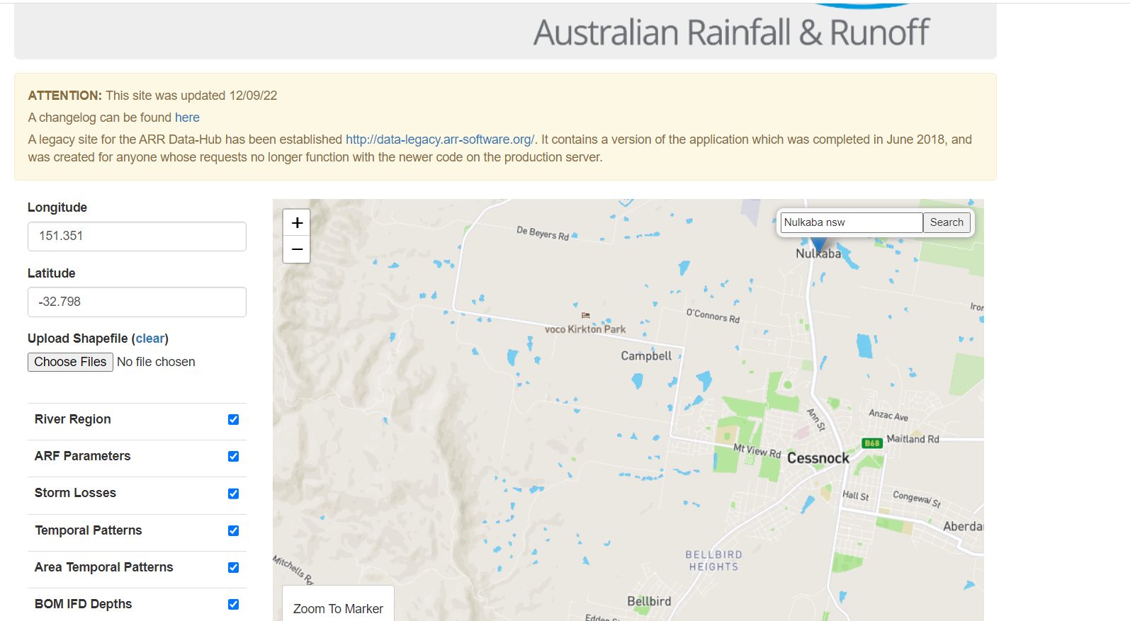
To give the intensity frequency duration data (IFD) for your location go to:
By using the map you will be able to identify your location and this will give the precise latitude and longitude data to locate specific information for you. Then press submit.

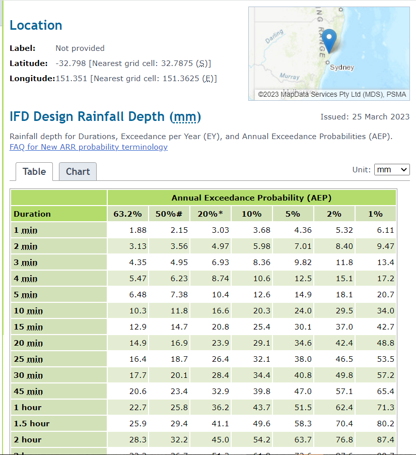
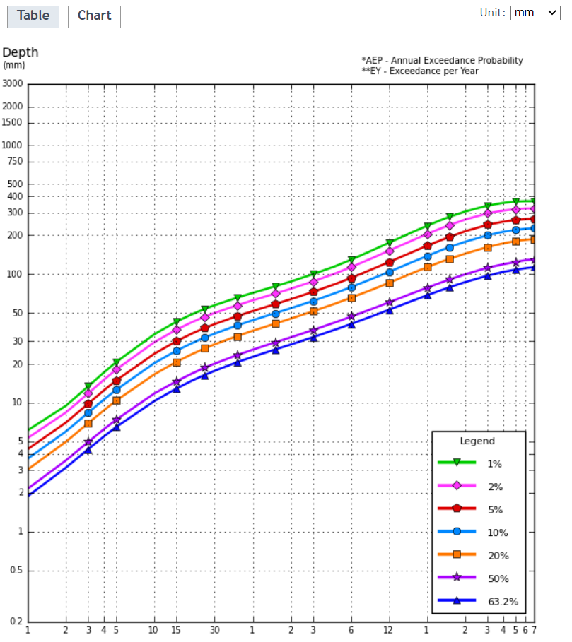
You are looking for the BOM IFD’s in the results and under the heading it says to click here and this will give you the information about your location as a table and as a graph. I searched for Nulkaba and gained these results:


The Table and the Graph provide the same information. Using the results of Thursday evening’s downpour, the annual exceedence probability can be ascertained. (Using the information for my place I could expect a 50% exceedence for the 31mm that fell in the hour).
What was your experience?
As you can see, there is more information about your location from the results of visiting the ARR site. You are most welcome to explore the site for further information that can impact your farming, weeding, or revegetation program.
Happy researching.
The Property Detective.

