Investigating Revegetation
What was there before?
The Hunter Region Landcare Muster held on the First April 2023 gave Landcarers an opportunity to listen to Peter Dixon on the approaches taken to address Revegetation and what this could involve. Today I want to look at steps that can be taken to find out what our Landcare/property patch was like in the past.
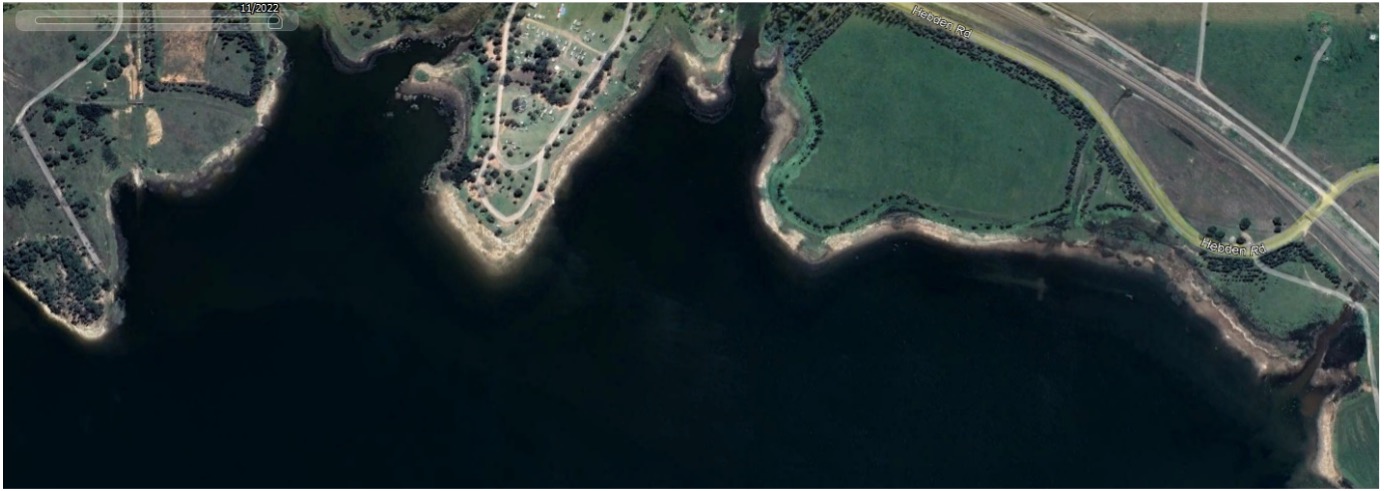
You are already familiar with Google Earth and the history icon on the Web Site. (Property Investigations 3)
Some other web Sites you may wish to explore include:
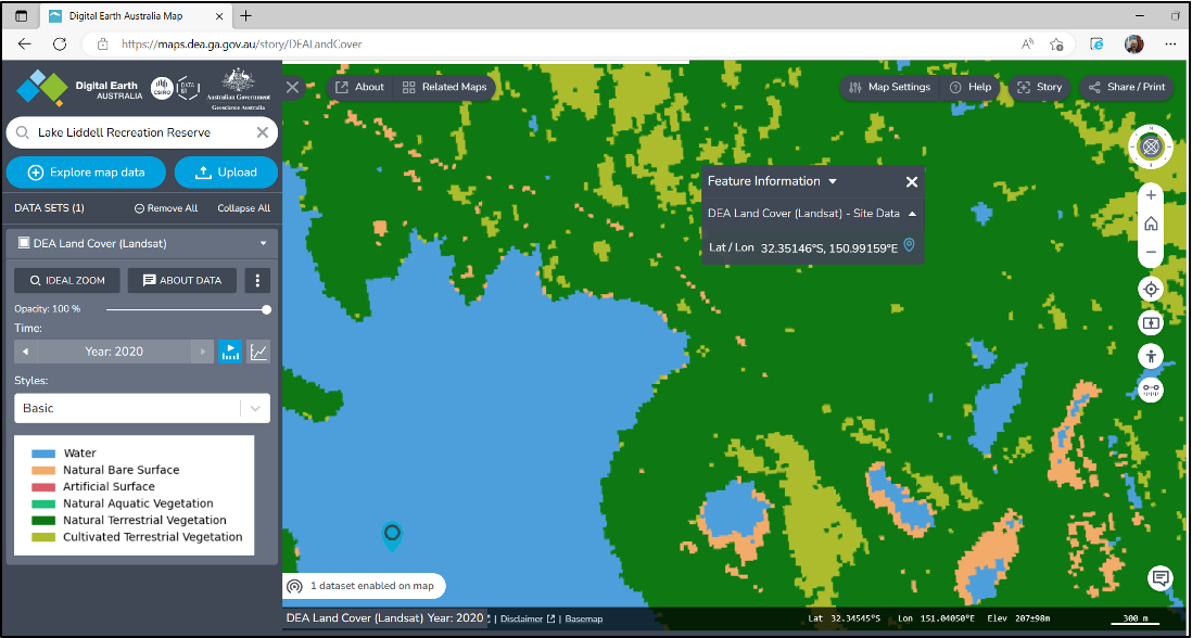
Digital Earth Australia (you will need a location to identify your site.)
https://www.dea.ga.gov.au/products
You then look for Land Cover on the web page.
This provides a pixilated image of the location and suggests the type of vegetative cover present. There is scope to vary the year to provide other computer-generated imagery. For Lake Liddell it looks like this for the year 2022:

Historical Imagery
https://www.spatial.nsw.gov.au/products_and_services/aerial_and_historical_imagery
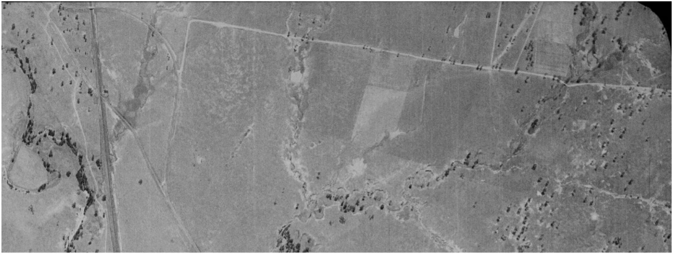
This provides photographic imagery of the site dating back to the 1960’s or earlier. In my search I was able to find images of the Lake Liddell Recreation Area Reserve prior to the construction of the lake. These early images give the sparce timber cover on the property and enables the identification of mature trees.

The 1965 image shows the rail link on the left of the image and the New England Highway overbridge at the top left corner. The site of the old level crossing is easily identified. These features can be identified in the Google map image. Portion of the old Hebden Road, clearly visible in the 1965 image, is hard to recognise in the 2022 image. The rail link was moved to allow the construction of Lake Liddell as was the New England Highway. Tree plantings are a clear contrast to the open paddocks of 1965.

Some trees present in 1965 have encouraged revegetation over the past 56 years. After identifying where on the property, your old trees are located, you are in a position to collect seeds and begin the propagation of new plants. Given that Lake Liddell Recreation Reserve was largely grazing land for over 140 year prior to the construction of the dam, other sources will need to be consulted to reconstruct a vegetation family approaching that of pre European settlement. (Open woodlands comprising of narrow leaf ironbark and spotted gums together with a range of grasses and other plants).
Happy Investigating.

