What a wonderful feature Google Earth has for property holders and Landcarers. From its tool bar we are able to get historic images of our property over time and we can also obtain a convenient Latitude and Longitude to use as a geographic point to help us locate information from other sources such as the Atlas of Living Australia.
Once we have Google Earth open on the computer we can use the tool bar for a variety of tasks. Today we want to look at two: Getting historic images of our site and obtaining a grid reference for our site.

Property over Time
- Identify your location in Google Earth.

- Look at the tool bar to find historic images (Circled in red).
- Click on it and a bar will appear with a slider that will enable you to see images of your property in the past (Red Arrow). Use your mouse to change the date of the image by moving the slider to each of the white lines. Each line represents a different time for an image being taken. (You can check the date of the image from the bar at the bottom of the map where you can read Latitude and Longitude: See step 7 in the following section)
4. Using your print screen button on your computer you will be able to assemble a series of images for your property.


Finding a grid Reference
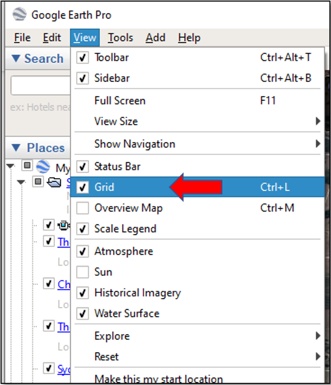
- Locate the view menu on you Google Earth page.
- From the drop- down Menu tick the Grid box
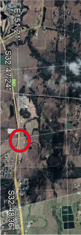
- This will change your Google Earth screen so that a series of imaginary lines of Latitude and Longitude appear across the map
- By changing the magnification of your google map you will also see adjustments to the lines of Latitude and Longitude. Find the most convenient and then take a screen shot.
- This will give you a record of your patch with a convenient point as your grid reference.
6. The Geographic Location shown on the Graticule Map last edition coincides with the location where E151°21’ intersects with S32°48’on the Google Map.
(Please note that when using Latitude and Longitude the Degrees, minutes and seconds are in units of 60.
Sixty seconds in a minute, sixty minutes in a degree and 360° representing one rotation).
7. As you move the cursor across the Google Map screen you can obtain a GPS location for any point by looking at the details at the bottom of the screen.
I was able to hold the cursor almost over my reference point.
NB: If you are using a magnetic compass in the field then you will need to correct for magnetic variation to obtain True North! (That is another quick lesson for another time)
Happy investigating.


